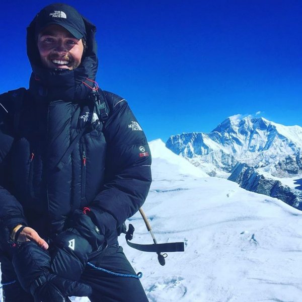
Joachim Bundli Andresen
-
Innlegg
5 -
Ble med
-
Besøkte siden sist
Om Joachim Bundli Andresen

-
 Joachim Bundli Andresen endret sitt profilbilde
 -
Hei! Jeg var nylig på tur til Russland og Elbrus. Jeg ønsker å dele eventyret med dere! Kanskje noen av dere skal ta turen selv og får et inntrykk av hva som venter dere! Det er et flott fjell i mine øyne, og kanskje fått et rykte på seg at det er fult av søppel og skit. Slik fant jeg det ikke, jeg fant frodige dalsider og et hyggelig folkeslag! Håper rapporten kan inspirere. Jeg legger ellers ut ekspedisjoner og eventyr på https://www.facebook.com/hikeandadventure/?ref=bookmarks Gi meg gjerne en kommentar om hva du synes! Mt. Elbrus This adventure is all about the highest mountain in Europe, Mt. Elbrus, reaching 5642m into the sky. Elbrus is a sleeping stratovolcano, located in the European part of Russia. You find this mighty mountain in the Caucasus-mountains, on the border to Georgia. Elbrus has two different peaks where the west peak is the highest, and the one I was aiming for. My adventure began in Moscow, and goes like this: When I woke up in Moscow, I didn’t know what to expect of the city. In the capital of Russia, you find old, gorgeous and enormous buildings. The people were kind, warm and helpful and the only difficulties I encountered was the language. I think this only gives a more joyful way of meeting new people, when you must be creative to be able to communicate with language berrier. During my day in Moscow I got to see the red square, Kremel and the iconic Saint Basil’s Cathedral. The capital was filled with joy and excitement with so many different nationality’s due to the world championship in football. People where singing their national songs in the streets, cheering for their country. After a day of sightseeing in Moscow it was time to move towards the mountains. From the capital, I flew to Mineralnye Vody. From this location, I got picked up with my guide from Pilgrim Tours and drove 4 hours to a city called Cheget, situated in the lower path of Elbrus. During the road trip the I got to view some striking scenery’s out the window. When I reach Cheget, the hotel was in a forest with stunning surroundings of mountains covered in snow. I even had a breathtaking view just outside the window from my room. I was so stoked to be here! During breakfast on the hotel I finally got to meet the rest of my team. The team was a great mix of nationalities where USA, France, Vietnam and Norway was present. After breakfast, we headed out for an acclimatization hike to Cheget Mountain with an altitude of 3100m above sea level. To get on to the mountain we used chairlifts, and I'm sure they lasted since the Soviet Union. They were colored, and a perfect way to use all your energy to turn your head all around because of the staggering views. While up on Cheget mountain I got this wonderful view of the mountain range, it was peaks everywhere. You can't summit this mountain due to heavy security and armed guards because of the borderline to Georgia. After our first day of hiking I felt great, I was ready to head to the slopes of Mt. Elbrus. We had a short brief and an equipment check before we drove to the foot of the mountain. On the foot of the mountain there is lifts that takes you up on the mountain. In total, there is three lifts that takes you to an elevation of 3800m, where the huts are positioned. These huts work as a base camp. We enjoyed a lunch with a staggering view before we were starting to hike to higher altitude, to prepare for even greater altitude. From the huts, we hiked up to Pastukhov rocks, 4800m above sea level. This hike is tough climb, climbing 1000m into thin air and the skies. There is in fact some rules you should follow when climbing in high elevation. It’s always best to climb high and sleep low, because this will give a boost of red blood cells so you can keep up with the altitude. However, you should never sleep higher then 600 to 700 meters higher from where you slept the night before. I found this acclimatization a bit of a struggle and way to quick. When I returned I could feel the headache. Luckily for me this headache past away during the night. Sleeping in a hut or a container filled with 7 other people is not that easy. It was difficult for me to fall asleep due to the altitude. In higher altitude, your heartrate increases to help the body to adapt to the lack of oxygen. When I woke up I knew we were supposed to have a rest day. I had a great time and found the relaxing day very useful. During the day, I learned and practiced self-arrest. Self-arrest is a technique employed in mountaineering, in which a climber has fallen and is sliding down a snow or ice-covered slope arrest the slides by themselves with the use of a glacier axe. This is an important skill to know if you fall or slide because the slope is steep and it's a long way down. When we finished the practice, we got served dinner and an update on our summit attempt. We got the latest update on the weather and the forecast was not looking good. It was forecasted thunderstorms and strong winds. Nevertheless, we made the decision to push for the summit during the peaceful night: Tror ikke filmen funker 😕 I found my sleeping bag and gave my body a last rest. During the four hours of resting, I listen to the thunderstorm outside. The thunderstorm was powerful and you could hear the power of wheatear. I didn’t sleep the last hours before my summit attempt, only lising to the thunder and luckily it went by around 22.00. I got dressed at 22.30, finding all my equipment such as crampons, glacier axe and head torch before I headed over to the eating container. Our schedule was to start climbing from the huts at midnight. The summit push is a real struggle and one of the toughest summit push of the seven summits. You need to climb 1800m in elevation from the huts to reach the summit. I was climbing with two other persons, the rest of my group took the snowcat, and drove up to Pastukhov rocks 4800m. During the hours from midnight I witnessed several people driving up the mountain, but I didn't get the point of driving up. I was here to climb a mountain, not drive up a mountain. Four hours into to climb we reached Pastukhov rocks. At this location, we meet up with the rest of my group. I could feel the excitement from my group, everyone with the same ambitions, to reach the highest point in Europe. From Pastukhov rocks the climb continued to the Saddle, located at 5300m above sea level. The wheatear was perfect, the sun was shining and there was almost no wind at all. This made us so happy that we had to dance for a short time in the higher slopes of Elbrus: IMG_1418.mp4 From the Saddle, we spent three more hours of climbing. During this period, the wheatear turned quickly and we found our self in a snow blizzard and a complete white-out. We climb in fixed ropes making it possible to continue towards the summit. The wind was cold, and I became covered with snow and ice crystals. After 11 demanding hours of climbing in thin air I finally reached the highest point in Europe, the summit of Mt. Elbrus 5642 meter above sea level. I felt proud, happy and relieved to reach the summit. I only got to spend 10 minutes at the summit, but I didn’t have any view due to the snow blizzard and it was a dangerous place to be. It was time to get out of the snow blizzard and down to thick air. During the ascent, it was only me and my new French friend who climb all the way down to the huts. In total the climb took 15 hours but it was all worth it. The people, the views, the feeling of accomplish the highest mountain in Europe made the climb memorable. Thank you for taking a part of my adventure towards Elbrus, the highest mountain in Europe. I hope I managed to inspire you to get out in the wilderness to experience new feelings. Bring your friends for an adventure to create everlasting memories. If you enjoyed this adventure, feel free to follow my future expeditions and adventures.
-
- 9
-

-
- ekspedisjon
- elbrus
- (og 2 andre)
-
Hei! Jeg var nylig på fjelltur i Afrika, Kilimanjaro. Dette var starten min på 7 summits, og reiser videre til Elbrus allerede neste uke. Gjennom dette innlegget forteller jeg hvordan jeg opplevde fjellet, og dere må gjerne stille spørsmål om du lurer på noe, eller om du skal til det høyeste fjellet i Afrika. Jeg legger ut ukentlige turer og reisemål på https://www.facebook.com/hikeandadventure/ Kilimanjaro When you are climbing this mountain, you go through the rainforest, heath, moorland, alpine desert and arctic climate zones. It’s been said that a Kilimanjaro climb is like traveling from the equator to the North Pole. Throughout this story, you can take a great part in my adventure on one of the mountains in the seven summits. The adventure takes place in Tanzania, Africa, and started out something like this; The sun was rising on a bright and clear late summer day in Norway. I didn't sleep to much that night, I was too excited. When I woke up on this clear day in the end of August, my adventure towards the roof of Africa, Kilimanjaro, was about to begin. I gathered all my equipment I had prepared over the last couple of days and got a lift to the airport. I was traveling alone, and all the people at the airport looked so excited and ready for a time of from their everyday life and so was I. My first flight took me to the Netherlands, where I had a connecting flight to Kilimanjaro airport in Tanzania. During my flight, I stared out the window for hours looking down on the white clouds that looked like cotton candy, always in a change. The feeling of being above the clouds is hard to describe, but a feeling I’m willing to chase. After several hours of staring out the window I finally arrived at Kilimanjaro airport. From the airport, I got a lift to Moshi by the agency I was climbing this mighty mountain with. The municipality of Moshi is in the Kilimanjaro Region and is situated on the lower slopes of Mount Kilimanjaro. The first morning I woke up in Moshi, I felt the warmth of the sun. The first day in Tanzania was a rest day after the travel. My adventure had begun, and I had a day to experience the life of Moshi. Luckily for me I met a guy at the hotel, Agre, who wanted to show me around his birthplace. At first, he brought me on an adventure to the local food marked. The marked was crowded with people where they sold fruits and vegetables, which tasted juicy. After the food market, we drove away from the main city on Agre’s motorcycle to the sugar and rice plantations. In these areas we found some monkeys, and it was really many of them. On our way, back we had a lunch where we ate the national dish Ugali and Nayama Choma. Ugali is a stiff dough prepared with cornmeal. We combined it with nayama choma, which is grilled meat and typical for the local people. When I arrived back at the hotel I did my last preparation before a life in tent on the mountain for the following days. I woke up early in the bed of the hotel, the last morning I was going to wake up in a bed, because on the mountain of Kilimanjaro you sleep in tent. From Moshi, we drove in jeeps to the Lemosho gate. Along our road trip the scenery of the landscape was stunning, with its iconic trees on the vast savannah. I was even so lucky to see giraffes and zebras grazed on the savannah. The sight was amazing and I have never in my life spotted animals like these in the wild before. Eventually we reach the Lemosho gate, as the starting point for my hike. I was hiking the Lemosho rout towards the summit of Mount Kilimanjaro, Uhuru Peak. The starting point is located on an elevation of 2300 meter above sea level. During this first day, our main goal was to reach camp Mti Mkubwa, which means big tree in Swahili. Too get to this destination I had to trek through the rainforest, climbing about 300 meters up towards the clouds. The path to the camp site was solid red sand, and I walked on the red sand with the jungle around me. The sounds of insects and monkeys, and the wind made me excited. On my first day of trekking we saw some colobus monkeys playing around in the high tree tops. After trekking for three hours we reach Big tree camp, and my tent was already ready when I arrived. The dinner was also ready to be served, and enjoying a dinner in the middle of the rainforest made me even more exited. The sun set, and the stars took over the skies, and I felt asleep to all the sounds of the forest in my tent made it a great rest. I woke up to the same sounds as I felt asleep with the night before. The sun was up, and the breakfast was almost ready. For breakfast I got served porridge, filled with a lot of energy for the hike ahead. From Mti Mkubwa, I was hiking almost 18km, and climbing over a 1000 meter in altitude to Shira II. I started out in the rainforest but as I quickly gained altitude towards Shira camp we came out of the rainforest and stepped into the heather and moorland climate zone. All the vegetation was almost gone, because of the heath that strikes you, and it’s hard to find any shadow. When I arrived on the Shira plateau the summit of Kilimanjaro, Uhuru Peak, revealed itself. I was above the clouds, and I could look down on the top side of them, almost like an ocean. A white ocean that was slowly changing into new shapes and forms. The volcano cone on Kilimanjaro was visible with its iconic glacier on top. The glacier on Kilimanjaro has been used for research to see how the temperature on earth is drastically changing. It's been said that the glacier could be gone by 2030. I reached Shira camp I, and had a quick stop here for lunch, before I continued my way to Shira II to meet up with rest of my group. On the third day on the mountain it was finally time for me to set a new elevation record. My highest record was 3776 meters above sea level when I climbed Mount Fuji in Japan. On this third day were we going to Lava Tower on elevation of 4600 meters. This was supposed to be an acclimatization day. Acclimatization is the process by which the body becomes accustomed to lower availability of oxygen in the air and can only be achieved by spending time at various levels of altitude before progressing higher. Our final goal was to reach Barranco on an elevation of 3950m. This made the day a perfect acclamation day. From Shira II, the path towards Lava Tower started out steep, and I could for the first time feel the thin air. I could feel it in that way that every step was more demanding than before. I also had to breath a lot more, and carefully keep track of my heart rate. To prevent altitude sickness is also very important to stay hydrated, and it’s recommended to drink 3 liters a day. From Shira II we walked for four hours to reach Lawa Tower. At this location, we ate lunch and had a short rest before the path continued down towards Barranco camp. On our decent we slowly walked into the clouds, and a new form of vegetation. In the clouds plants started to arrive. The plants that was visibly was giant groundsels. They look something like a cross between a burned-up cactus and a pineapple, and its only found on Kilimanjaro. I woke to the clouds acting like waves of the ocean. The bright clouds came towards the mountain as waves back and forth. From the camp site the path starts out very steep. Climbers must conquer the famous Barranco wall also known as the breakfast wall. The wall is almost vertical, and a difficult part of the path. They call it the breakfast wall because its common to throw up during this part of the trek. The reason is a mix of elevation and that you ate breakfast only minutes before starting at this vertical wall. Luckily for me, my breakfast stayed inside me, giving me energy towards Karanga Valley. During this day, you stay on the same elevation turning it into a not so demanding path to the next camp. The Kranga Valley is located on an elevation of 3900 meters above sea level. From this location, I could see in Mount Meru, another volcano in Tanzania. The peak was shining in the glow of the sun, majestic over the clouds, and a breathtaking view on a bright and clear new day. Our goal for this day was to reach Barafu camp, the last camp before an eventfully summit push. Starting on this path to the next camp you enter the alpine dessert climate zone. Almost all the vegetation is gone, and rocks and sand is our new surroundings. While we walked this path, I walked with the summit on my left side. The majestic glacier and summit is still high over you. The elevation is demanding, but after the acclimatization day at Lawa Tower the body had adapted greatly. My breath slowly became a lot deeper and faster, and this is one of the mechanism in the body to adapt to greater elevation. The guides are even more careful about the phase we are walking in, and always reminds you to walk slowly. You get very familiar with the words, “Pole, Pole”, which means slowly, slowly. We reached Barafu camp around 16.00 in the afternoon. When we arrived, the tents were set and dinner was soon served. During dinner, we got notified that we were going to push for the summit already at 23.00. This gave me some hours to rest, but I found it hard to sleep because of the excitement on the summit attempt ahead. I didn't sleep, I couldn't sleep, I was so excited on the finishing task I had in front of me. I was wondering how it would be, and if I even manage to get to the roof of Africa, finally it was time to find out. I lighted my headlamp and got dressed in my sleeping bag. As I came out of my tent, the moon was slowly rising and shining it glow down on the people on the mountain. The glow was so bright that I could turn of my headlamp, and the moonlight gave me enough light. The last part on the path consist of sand. The sand is not that demanding that you would think. Because of the altitude, the sand freeze during the night and make it hard almost like concrete. This made it a lot easier, but every step in this elevation is tough. After we had walked for seven hours, we reach Gilman’s Point. This location is situated 5685 meters above sea level. When we arrived, the light was slowly returning after the darkness of the night. At this place on of the group member had to turn back because the member was overexerted. The rest of the group continued towards Uhuru Peak. The view of the last part is something I never seen anything like and it is hard to describe. The clouds almost melted into the glacier. It took my breath away, and I could see the icon sign which mark the highest point on the mountain. The sun was rising on the one side of the mountain, and the moon was setting into the clouds as I approached Uhuru Peak. I had made it. I had climb through five different climate zones, and stood on the highest free standing mountain in the world, the highest mountain in Africa, Kilimanjaro. No one else was higher than me on the entire continent Africa. Thank you for taking a part of my adventure towards Uhuru Peak, the summit of Kilimanjaro. I hope I managed to inspire you to get out in the wilderness to experience new feelings. Bing your friends for an adventure to create everlasting memories. If you enjoyed this adventure, feel free to follow my future expeditions and adventures.
- 1 svar
-
- 11
-
-
- kilimanjaro
- afrikastak
- (og 2 andre)
-
Mera Peak 6461m, Nepal
Joachim Bundli Andresen svarte på Joachim Bundli Andresen sitt emne i Turrapporter
Takk for at du setter pris på den! Ja, drømmer meg tilbake allerede! -
Mera Peak 6461m, Nepal
Joachim Bundli Andresen svarte på Joachim Bundli Andresen sitt emne i Turrapporter
Takk for grundig og god forklaring på dette med oksygen i høyden. 😃 -
Hei! Jeg har nylig bodd i Nepal, hvor jeg unnet meg flere fjellturer i både øst og vest. I den forbindelse ønsker jeg å dele min tur til Mera Peak, 6461 meter over havet med dere. Jeg beskriver turen på engelsk, håper dere finner den interessant og blir inspirert til å gå i det virkelig høye fjellet! IMG_9687.mp4 Mera Peak The clouds have always made me enthusiastic. The feeling of being above them or even better walk in them, make me feel marvellous. Throughout this story, you can take a major part in my newest adventure of peak climbing. I want to share my adventure to Mera Peak situated 6,461 meters above sea level in Himalaya with you. Welcome aboard on an adventure over the clouds and in the deep valleys in Nepal. My adventure started out in Lukla. The village of Lukla has a kind of famous airport, situated on high elevation on a hill side. The reputation appears from a perfect storm of small facts and factors. Tiny planes and turbulence is your least concern, making it the world’s most dangerous airport. From Lukla I began my hike towards the Zatrwa La pass which you can see in the second picture. The path to Zatrwa La went through some small settlements in a jungle of rhododendron trees. The rhododendron flower is known as the national flower of Nepal. During late March and April, the flower turns to blossom. The smell of this flower could remind you of pure incense. Could this be the hidden secret of why the local people of Nepal are always so warm and kind? All the native people I met during my path in this jungle greeted me with a Namaste and a warm smile. After the first day of hiking I settled down for a rest in Chutang, in a house built out of stones from the mountains. As dawn turned up, my adventure continued towards the pass. To get to the pass I had to climb 1300m in a steep ascent. The struggle of climbing in high altitude came back to me from my previous experiences with altitude from the roof of Africa, Kilimanjaro. The struggle went on for three hours and the climb was completed at the top of the Zatrwa La pass on an altitude of 4,600m. From the top of the pass the view took the breath out of me, with peaks so far the eye could see. Majestic above the clouds, the peaks covered in snow was shining from the light of the sun. The path continued down into a mystical valley filled with fog and clouds. The weather in the valley was heartless with winds and snow, creating a whiteout. Due to the weather conditions, I had to find shelter and spend the rest of the day in Thuli Kharka on an elevation of 4200m. This gave me an opportunity to sleep at a good height to become acclimatized for even higher elevation in the future. The weather turned during the night to great conditions on the fourth morning. This meant that the adventure continued deeper into the valley. The path was descending towards a village called Khote. This village is situated in the valley on an elevation of 2800m. The village offers different shops, showers and even internet. At this place, I could fill up my backpack with some energy and chocolate bars for the rest of the adventure. During my stay in Khote, the guides and porters sat around the camp fire and told stories from their mountain life, such as stories from Mount Everest and Ama Dablam. The different stories made my great passion for the mountains grow even higher. After a rest in Khote the path continued to Thangnak in a scenery that is hard to compete with. Walking in this valley was mystical. During the day, the clouds came into the valley and I was walking in the clouds. The path was located just beside a river created of the melted ice from the glacier on mount Mera. On the path to the next settlement, Thangnak, I came across a monastery located on the hill side. The monastery was built in the mountain, with painting and statues of the three gods in Buddhism. Here it was a monk who gave me his blessing to achieve my aim to stand on the summit of Mera Peak. While I hiked to the next settlement I slowly increased a higher altitude. Thangnak is located on the foot of the Mera mountain. It is surrounded by mountains such as, Kyasar and Gonggila. The tall mountains often gave sounds and sceneries of avalanches, which reminded me of some of the dangerous parts of being in these hard conditions. The next day my hike continued towards a new village called Khare. The distance between the settlements is not that far, but when trekking in high altitude you must have in mind that there is less oxygen and more demanding to get around. If you push too hard your body won’t be able to stay in greater altitude. In worst case, you would most likely suffer of altitude sickness which could be lethal. During the time I spent walking between these villages my destination finally turned up. Ascending almost 2000m above me, I saw Mera Peak. Luckily for me I had a rest day in Khare before the path led towards base camp and real great altitude. During the acclimatization day, I went up to a flag post to view the sunset. If you want to give your body an opportunity to stay in great altitude, here is a good tip for you; work high and sleep low. This will boost the production of red blood cells, doing it easier for the human body to transport and obtain a great flow of oxygen. My body took a great advantage of an acclimation day in Khare on an elevation of 4900m. I had regained energy and the body felt ready to the demanding task ahead. After lunch in Khare, an omelet with 8 eggs, I started my ascent to base camp. The campsite is located close by Khare on an elevation of 5250m. Most of the people hike straight to high camp, but if you consider the elevation from Khare to high camp, you are sadly asking for altitude sickness. During my hike, I met a lot of people who got sick due to the altitude because they went straight from Khare to high camp. The path and altitude drains your energy at all time, and the demanding climb makes your chances to reach the peak low. I decided along with the guide to spend a night in base camp, and I felt it was the right decision. The view was unbelievable, and during the sunset, the sky was filled with stars, there were so many of them. Spending a night in a tent in base camp gave me flashbacks of the tent life at Kilimanjaro. The true feeling of being out in the wildness could only be achieved if you spend some nights in a tent in my opinion. The task ahead was to find the path to high camp. The path was located on a glacier, called Mera Glacier. While walking on the glacier I had to wear crampons and use my ice axe from time to time. The ice axe is a perfect object to find deadly crevasses which are hiding in the glacier. The climb to high camp was affected by bad weather, and lack of visibility due to another whiteout. This made the climbing even more demanding, but it also gave me a motivation boost. The excitement of slowly reaching my destination and feeling the thin air. I reached high camp, I was above the clouds, and the camp site offered a breathtaking site. The view of Makalu just outside the tent and the view of the special campsite made me excited! It was time to gather all the energy that was possible to find. The time for the final push towards Mera Peak was soon arriving. The excitement grew in the tent, and a sleepless night with a lot of thoughts that seemed to never end, finally ended, and it was time. The clock was 03.00 pm. I had been waiting for 9 hours in my sleeping bag to start the most demanding part of my adventure. I placed my head lamp over my head, closed my jacket, and clipped the crampons to my mountaineer boots. The footsteps towards the summit could start to lead the way. The weather conditions were good. The stars were shining down at me, the wind was resting and it wasn’t that cold, maybe -15 Celsius. My footsteps were taking me higher and higher in a slow phase into the even thinner air. After climbing for two hours I finally reached an altitude of 6000m. At this time, you feel the low percentage of oxygen, and how much you breath for every step. On the summit of Mera Peak the percentages of oxygen is about 44%. If you compare this to altitude of sea level the percentages is 79%. The view became more and more beautiful while dawn set in. Several of the highest mountain were visible, such as Lhotse, Everest and Ama Dablam. The view and surrounding took the attention of the demanding task away. The majestic feeling of having the clouds underneath you, and gazing at the view on 5 of 6 highest mountains in the world. The view took all my attention from looking ahead on the summit. The ascent flatted slowly out and suddenly I only had a step wall of 100m to overcome before I could stand on the summit of Mera Peak. At 08.34 am, I stood on the summit of Mera Peak 6,461m / 21.197 ft. above sea level. What an adventure, what a view. My feelings around the summit is hard to explain, they were filled with happiness, fear, pride, and I felt amazing. Thank you for taking a part of my adventure towards Mera Peak. I hope I managed to inspire you to get out in the wilderness to experience new feelings. Bing your friends for an adventure to create everlasting memories. If you enjoyed this adventure, feel free to follow my future expeditions and adventures. My next adventure will take place in Russia, where I will try to summit Mount Elbrus, the highest mountain in Europe. This will hopefully be my second of the seven summits. Det var en fantastisk tur og eventyrene mine står ikke på vent. Jeg har nylig startet et nytt prosjekt med de høyeste fjellene på hvert kontinent, hvor jeg reiser til Elbrus i Juni som mitt andre fjell. Jeg har en Facebook side hvor jeg skriver om tips til turer rundt om i verden og andre eventyr jeg har i den norske naturen. Følg meg gjerne på min vei og forhåpentligvis bli inspirert! https://www.facebook.com/hikeandadventure/?ref=bookmarks Joachim B. Andresen
- 5 svar
-
- 9
-
-
- topptur
- ekspedisjon
- (og 1 andre)